
The Mahaweli River (Mahaweli Ganga) is the longest river in Sri Lanka and one of the country’s most important natural resources. Flowing from the central highlands towards the northeastern coast, this magnificent river supports agriculture, hydroelectric power generation, wildlife, and communities across several regions of the island.
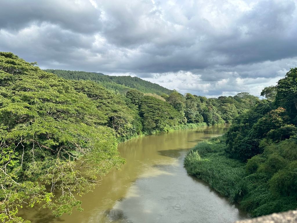
Stretching approximately 335 kilometres, the Mahaweli River passes through scenic mountain landscapes, fertile valleys, historic towns, and large reservoirs before reaching the sea near Trincomalee. Its river basin is also the largest in Sri Lanka, making it a vital part of the country’s water management and agricultural systems.
From its origins in the central highlands to its final destination in the Indian Ocean, the Mahaweli River offers a fascinating journey through the natural beauty and geographical diversity of Sri Lanka.
Where Does the Mahaweli River Start?
The Mahaweli River originates in the central highlands of Sri Lanka, where rainfall from the mountains and surrounding catchment areas feeds numerous streams and rivers.
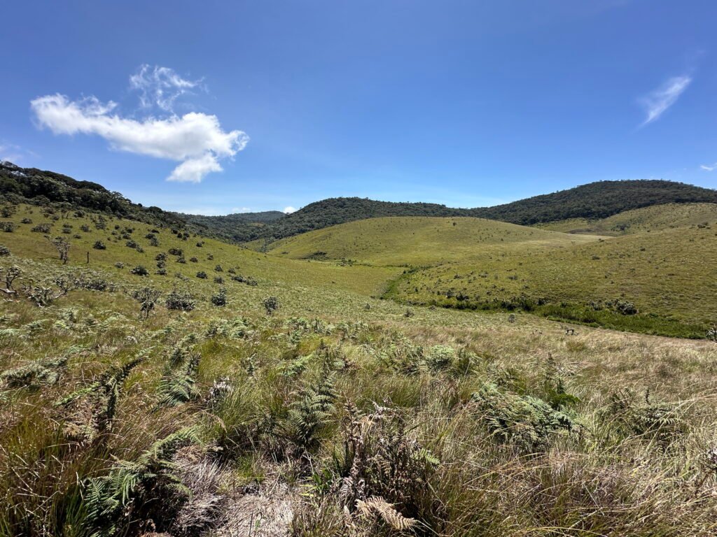
The upper catchment is associated with the Horton Plains region and nearby mountain ranges. Several streams, including the Kotmale Oya and Hatton Oya, contribute to the river system. These waterways join in the upper highlands, and the river develops into the Mahaweli Ganga around the Polwathura area near Pasbage, in the Gampola region.
The cool, wet climate of the central highlands provides an important source of water for the Mahaweli River. Rainfall from these mountainous areas flows through streams, tributaries, and valleys, eventually supplying the main river.
Although Sri Pada (Adam’s Peak) is sometimes associated with the origins of Sri Lanka’s major rivers, the Mahaweli River’s headwaters are generally associated with the central highlands around Horton Plains and the Kotmale region.
The Journey of the Mahaweli River Across Sri Lanka
The Mahaweli River follows a long route from the central mountains towards the northeastern coast. Along the way, it passes through several important landscapes and receives water from numerous tributaries.
Where Does the Mahaweli River Begin? The Agra Oya Journey from Horton Plains
Identifying the exact birthplace of the Mahaweli River is not straightforward. The river system originates in Sri Lanka’s central highlands, where numerous small streams flow down different mountain ranges and combine to form a complex network of waterways. These streams, fed by rainfall and the highland catchments, contribute to the formation of Sri Lanka’s longest river.
Despite the complexity of tracing its precise source, Horton Plains is widely recognised as the origin region of the Mahaweli River.
Therefore, understanding the birthplace of the Mahaweli River requires looking beyond a single spring or stream. Its origin is better understood as part of a wider highland watershed, with Horton Plains serving as the recognised starting region of this remarkable river system.
Agra Oya: A Waterway Born in Horton Plains
On the northern side of Horton Plains, small streams come together to form the Agra Oya, an important waterway in the upper Mahaweli River system.
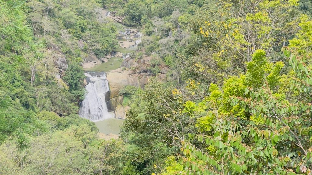
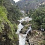
Within the dense forests of this mountainous region lies the beautiful Agra Ella waterfall. Hidden among thick vegetation, the waterfall is difficult to access, making it a relatively secluded natural attraction. The surrounding forest and rugged terrain demonstrate the natural beauty of the central highlands, where rainfall sustains streams that eventually contribute to Sri Lanka’s major river systems.
From its headwaters near Horton Plains, this branch of the Agra Oya flows towards Dayagama and Agarapathana, passing through the scenic highland landscape.
A Second Source from the Ambewela Area
Another stream originates around the Ambewela area and is also locally known as Agra Oya. This waterway flows through the highlands towards Henfold Estate, near Lindula.
The two streams meet at Henfold Estate, combining their waters to form a larger watercourse. From this confluence, the Agra Oya continues towards Lindula and Talawakelle, carrying water collected from different parts of the central highlands.
The Confluence of Agra Oya and Nanu Oya
As the Agra Oya approaches Talawakelle, it is joined by Nanu Oya, another important waterway originating in the central highlands near Nuwara Eliya.
The confluence increases the volume of water flowing downstream, creating a larger river system. This watercourse continues to be identified as Agra Oya in the local geographical description.
Upper Kotmale Reservoir: A Landmark on the River’s Journey
Near Talawakelle, the waters of the Agra Oya feed into the Upper Kotmale Reservoir, created by the Upper Kotmale Hydropower Project.
The reservoir and its associated dam are important landmarks in Sri Lanka’s hydroelectric power network. They harness water from the upper river catchment to generate electricity, illustrating how the natural waterways originating in the central highlands contribute to the country’s energy resources.
At the end of the Upper Kotmale Reservior, name of Agra oya ends, and begins the Kothmale oya (River).
The Upper River: Kotmale and Gampola Areas
The upper reaches of the Mahaweli River are closely connected with the Kotmale region, Gampola, and the surrounding central highlands.
This part of the river system receives water from streams flowing down the mountain slopes. The Kotmale Oya is one of its major tributaries, and the region’s high rainfall helps maintain river flow.
The Kotmale Reservoir and the Upper Kotmale hydropower development are important features of the wider river system. These projects help generate electricity and regulate water resources.
The landscapes around Kotmale and Gampola are characterised by green hills, tea plantations, forests, and winding waterways.
Peradeniya and Kandy
As the river continues downstream, it flows through the Kandy region and past Peradeniya, one of the best-known locations along the Mahaweli River.
The river is particularly significant around Peradeniya, where it passes near the University of Peradeniya and the Royal Botanic Gardens. The surrounding riverbanks and green landscapes make this area an attractive place for visitors interested in nature and photography.
The Mahaweli River also contributes to the natural setting of Kandy, a major cultural destination in Sri Lanka. Several bridges and riverside locations provide views of the waterway as it winds through the region.
Polgolla and the Mahaweli Development System
Downstream from the Kandy area, the Mahaweli River reaches Polgolla, where a barrage plays an important role in managing and diverting water.
The Polgolla Barrage forms part of the Mahaweli Development Programme, a major water-resource development initiative in Sri Lanka. Water diverted from this area can be transferred through canals and tunnels towards irrigation and hydropower systems serving other parts of the country.
The Polgolla system is an important example of how the river’s natural flow has been integrated into large-scale water management infrastructure.
Victoria Reservoir and the Teldeniya Region
One of the most significant landmarks associated with the Mahaweli River is the Victoria Reservoir, located east of Kandy.
Created by the Victoria Dam, this large reservoir supports hydroelectric power generation and water management. Its surrounding hills and extensive stretches of water create an impressive landscape.
The wider Victoria Reservoir area is associated with the Teldeniya region and nearby rural communities. Before the reservoir was created, parts of the valley contained settlements and agricultural land that were subsequently affected by the development project.
Victoria is one of the major reservoirs in the Mahaweli hydropower system and an important landmark in Sri Lanka’s modern water-resource development.
Randenigala and Rantambe Reservoirs
Further downstream, the river enters the Randenigala Reservoir and continues towards the Rantambe Reservoir.
These reservoirs are key components of the Mahaweli hydroelectric and irrigation network. Together with Kotmale and Victoria, they help regulate river flows and support electricity generation.
The surrounding areas feature hills, forested landscapes, and waterways that form part of the wider central and eastern river basin.
The reservoirs also illustrate the importance of carefully managing water released from the upper river system, particularly during periods of heavy rainfall and changing irrigation demand.
Minipe, Mahiyanganaya and the Eastern Agricultural Regions
After the Rantambe area, the Mahaweli River continues towards Minipe, where an important diversion system distributes water through canals on both banks.
These canals carry water towards agricultural areas downstream. The wider Mahaweli Development Programme has helped expand irrigation infrastructure in Sri Lanka’s drier regions, supporting paddy cultivation and other agricultural activities.
As the river leaves the central highlands, its surroundings gradually change. Mountain landscapes give way to broader valleys, plains, irrigation channels, and agricultural land.
Mahiyanganaya Rajamaha Viharaya is also located beside the Mahaweli River.
This transition highlights the river’s role in connecting the wet highlands with the agricultural regions of eastern and north-central Sri Lanka.
Manampitiya and the Lower Mahaweli River
In the lower reaches, the Mahaweli River flows through the Polonnaruwa region, including the area around Manampitiya.
Manampitiya is well known for its long railway bridge across the Mahaweli River, which provides a distinctive view of the river and its surrounding landscapes.
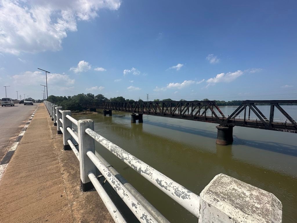
The river continues through the lowland plains, where its water supports irrigation, wetlands, and rural livelihoods. Its lower basin is especially important for agriculture because rainfall is more seasonal than in the central highlands.
As the river approaches the northeastern coast, it forms part of an extensive river and wetland environment before finally reaching the sea near Trincomalee.
Mahaveli river end its journey and joins the Indian Ocean at Upparu village accross Upparu bridge.
Important Places Along the Mahaweli River
The Mahaweli River is connected with many geographical, cultural, and engineering landmarks across Sri Lanka.
Some of the most important places and features associated with the river system include:
- Horton Plains and the central highlands: Important headwater and catchment areas that supply water to the upper river system.
- Kotmale: Kotmale reservoir area associated with hydropower generation.
- Gampola: Ambuluwawa Tower
- Peradeniya: University of Peradeniya, Royal Botanic Gardens
- Kandy: Temple of Tooth
- Polgolla: Polgolla reservior and water-diversion barrage.
- Victoria Reservoir
- Randenigala Reservoir
- Rantambe Reservoir
- Minipe: An important irrigation diversion area.
- Manampitiya: Known for its railway bridge across the Mahaweli River.
- Polonnaruwa region: An important agricultural area in the lower river basin.
- Trincomalee: The coastal region where the Mahaweli River reaches the sea.
These locations illustrate the river’s importance to Sri Lanka’s natural environment, infrastructure, agriculture, and regional development.
Major Tributaries and Branch Rivers of the Mahaweli River
The Mahaweli River is supported by a network of tributaries that collect rainfall from the central highlands, the Knuckles Mountain Range, and other parts of its extensive catchment.
A tributary is a smaller river or stream that flows into a larger river. Tributaries help maintain the main river’s water supply and connect different parts of the surrounding landscape.
Important tributaries of the Mahaweli River system include:
Kotmale Oya
Kotmale Oya is one of the major tributaries associated with the upper Mahaweli River. It drains parts of the central highlands and flows through the Kotmale region, where the river system has been developed for hydropower and water management.
Hatton Oya
Hatton Oya contributes water to the upper Mahaweli system. Its catchment areas Marlborough Division, in Hatton receives rainfall from the central highlands, and it is part of the network of streams that join to form the main river. Hatton oya joins the Kotmale Oya at Pallegama area and after combined river get the name of river as “Mahaweli”.
Nanu Oya
Nanu Oya origins from the Gregory Lake in Nuwara Eliya region. It joins to the Agra oya at Talawakelle and contributes to the Kotmale Oya river system and ultimately to the Mahaweli River.
Hulu Ganga
Hulu Ganga flows from the Knuckles Mountain Range and joins to the Victoria Reservior at Orutota area.
Uma Oya
Uma Oya originates from Bomburuella Reservoir. It drains parts of the central and Uva highlands and joins the Rantambe reservior. The Uma Oya water-resource development scheme is also associated with hydropower generation and water transfers.
Badulu Oya
Badulu Oya originates at Namunukula mountain ranges and drains parts of the Badulla region and forms part of the wider Mahaweli catchment. Badulu oya joins the Mahaweli river in Minipe area.
Loggal Oya
Loggal Oya’s origin is from Passara region. It is another tributary associated with the eastern side of the upper and middle Mahaweli basin. It creates to the Loggal Oya Reservior and joins with the Mahaweli river around Ambagahapelessa area.
Amban Ganga
Amban Ganga is a major river in the wider Mahaweli basin, draining areas around Matale and the Knuckles region. It joins the Mahaweli River at north part of Wasgamuwa National Park and is important for regional water resources.
Other Tributaries
Other streams and tributaries associated with the Mahaweli basin include Belihul Oya, Hulu Ganga’s smaller feeder streams, Atabage Oya, Pundalu Oya, and several local waterways.
The exact tributary list depends on whether the focus is the main river channel or the entire Mahaweli river basin. Some waterways enter the main river directly, while others join through tributaries or reservoir systems.
Major Reservoirs and Their Importance
The Mahaweli River is central to Sri Lanka’s largest multipurpose water-resource development system. Several reservoirs and diversion structures have been built along the river and its tributaries.
The principal reservoirs and related infrastructure include:
| Reservoir or structure | Main importance |
|---|---|
| Upper Kothmale Reservior | Hydroelectricity |
| Kotmale Reservoir | Hydroelectricity and river-flow regulation |
| Victoria Reservoir | Hydroelectricity and water storage |
| Randenigala Reservoir | Water storage, flow regulation, and hydropower |
| Rantambe Reservoir | Hydropower and water management |
| Polgolla Barrage | Diversion of water for irrigation and related systems |
| Minipe diversion system | Distribution of water to downstream agricultural areas |
These developments help supply water for irrigation, generate renewable electricity, and manage seasonal differences in water availability. They also influence river ecosystems, sediment movement, and the natural timing of flows, making responsible water management essential.
Why Is the Mahaweli River Important to Sri Lanka?
The Mahaweli River is much more than a geographical feature. It is an essential source of water and a major contributor to the country’s agriculture, economy and environment.
Agriculture and Irrigation
Water from the Mahaweli system supports extensive agricultural areas, particularly in Sri Lanka’s dry and intermediate zones. Irrigation infrastructure helps farmers cultivate paddy and other crops in areas where rainfall alone may not provide sufficient water throughout the year.
Hydroelectric Power Generation
Reservoirs and power stations associated with the Mahaweli system generate hydroelectricity. Facilities at Kotmale, Victoria, Randenigala, and Rantambe are among the major components of this network.
Drinking Water and Local Communities
The river and its catchment contribute to water resources used by communities in different parts of the country. Protecting the quality of the river is therefore important for public health, livelihoods, and long-term water security.
Wildlife and Biodiversity
The Mahaweli basin contains a wide range of habitats, from montane catchments and forested hills to wetlands and lowland riverbanks. These environments support fish, birds, aquatic organisms, and other wildlife.
Tourism and Scenic Landscapes
The river adds natural beauty to destinations around Kandy, Peradeniya, Kotmale, Victoria Reservoir, and other areas. River views, bridges, reservoirs, and green valleys contribute to the appeal of Sri Lanka’s central highlands and inland landscapes.
Where Does the Mahaweli River End?
The Mahaweli River flows towards the northeastern coast of Sri Lanka and reaches the sea at Trincomalee Bay, near Koddiyar Bay.
After crossing the inland plains, the river’s final stretch passes through the lower Mahaweli region before its freshwater reaches the coastal environment. The estuarine and coastal areas around its mouth are important for aquatic habitats and the movement of water, nutrients, and sediment between the river and the sea.
Trincomalee is known for its large natural harbour and deep coastal waters. The Mahaweli River’s connection with this coastal region marks the end of its long journey from the central highlands.
The river’s route therefore links Sri Lanka’s wet mountainous interior with the drier eastern and northeastern lowlands, demonstrating the geographical diversity of the island.
Frequently Asked Questions About the Mahaweli River
What is the length of the Mahaweli River?
The Mahaweli River is approximately 335 kilometres long, making it the longest river in Sri Lanka. Published figures may vary slightly according to the measurement method and the definition of the river’s headwaters.
Where does the Mahaweli River originate?
The river originates in the central highlands of Sri Lanka, with its headwaters associated with the Horton Plains region and surrounding mountain catchments. Streams such as Kotmale Oya and Hatton Oya contribute to the upper river system.
Which districts does the Mahaweli River flow through?
The Mahaweli River basin extends across several districts, including Nuwara Eliya, Kandy, Matale, Badulla, Polonnaruwa and Trincomalee. The full river basin covers a wider area than the main river channel itself.
What are the main tributaries of the Mahaweli River?
Important tributaries of the Mahaweli system include Kotmale Oya, Hatton Oya, Nanu Oya, Hulu Ganga, Uma Oya, Badulu Oya, Loggal Oya, and Amban Ganga.
Which reservoirs are connected to the Mahaweli River?
The major reservoirs associated with the river system include Upper Kotmale, Kotmale, Victoria, Randenigala, and Rantambe. These reservoirs support hydropower generation, water storage, and irrigation management.
Where does the Mahaweli River flow into the sea?
The Mahaweli River reaches the sea near Trincomalee on Sri Lanka’s northeastern coast, flowing into the Trincomalee Bay and Koddiyar Bay coastal area.
Summary of Mahaweli River
The Mahaweli River is one of Sri Lanka’s most valuable natural assets. From its headwaters in the central highlands to its mouth near Trincomalee, it travels through mountains, valleys, reservoirs, agricultural plains, and important towns.
Its tributaries collect water from a broad catchment, while its reservoirs and irrigation systems help support agriculture and hydroelectric power generation across the country. At the same time, the river sustains wildlife, local communities, and scenic landscapes.
Understanding the journey of the Mahaweli River provides a deeper appreciation of Sri Lanka’s geography and the importance of protecting its rivers and water resources for future generations.



One Reply to “Mahaweli River Sri Lanka: Origin, Route, Reserviors & Tributaries”